
|
|
|


I saw that, and don't believe that we've lost that much livable land, The Atchafalaya basin has been unlivable forever, along with most of the coastal marsh, is their coastal erosion, yes, can it be fixed? I have no idea, one of the main causes is that we have prevented the Mississippi to flood or change course and deposit silt along our part of the Gulf. Really they should be dredging the Mississippi and redepositing it all along the coast, to try and emulate natural redirection of the river. Or let it flood out everything from Mississippi to Houston as it moves.Originally Posted by Blue Dawg

Not livable, walkable. Which, to be fair, is not what the original map was based on, I don't think. The land loss is a fact though.
That would cost a great deal. Is it worth it? Coastlines change, its a fact of life in a swamp. We noticed this weekend that the surface of the Cajun's field is well below sea level.
Exactly the original map was just the boundary of the states.
It still hurts my heart, all the same ...
From looking at some detailed maps it appears to me that the Red River already flows into the Atchafalaya. There is a connection to the Mississippi River for barge traffic which I think is called the outflow channel. The Corps of Engineers has been fighting the Mississippi for years. I remember the first time they opened the Atchafalaya floodway from the Mississippe - back in the spring of 1973. Except for the one high point the whole basin was flooded from one side to the other. We had gone over from Port Arthur, Texas to New Orleans. It was so creepy on the levee at Jackson Square. Water was almost to the top of the levee and the street on the land side was about 6-10 feet below. The docks must have been partially flooded becasue it looked like the ships were a 100 yds from the banks. That's where I read that the River is about 200 feet deep there.
Another tid bit. Captain Henry Shreve who is famous for clearing the log jam on the Red River also channeled the Mississippi at its mouth to make it sort of self cleaning. I am not sure which pass he did.
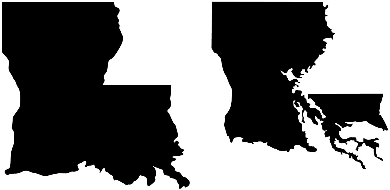
While correct we are losing lots of land to coastal erosion, this is definitely not an accurate picture of the land lost or what will be lost. The Atchafalaya basin is actually still growing; its delta is one of the few parts of the state gaining land. So that part of the state should still be there. Second why is there a sliver of land missing just to the east of Baton Rouge? That land is above sea level and not connected to the sea. Why would it disappear? Would Mississippi be losing land too at that state line? Also the same question goes for the land missing just east of what would be Natchez, MS. Why is that disappearing on the image?
And has been brought up, the left image is just an outline of the state without taking into account Louisiana's bodies of water. Neither lake Pontchartrain is there, nor is Lake Maurepas (Spelling?). It makes the differences look even more dramatic.
The idea is right, but this graphic is wrong.
 Posting Permissions


 Reply With Quote


