
Originally Posted by
weunice

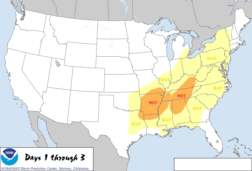
There are a couple of cells headed towards the Shreveport area now. One is rotating, heading just south of Oil City right now. It is SVR (Severe Thunderstorm) warned right now although if that couplet gets much stronger I expect an upgrade to a Tornado warning. There is another SVR warned cell that might slide south of town.
Vilonia AR seems to have taken a hit from a rather intense tornado. A rather known storm chaser is reporting that he saw scoured pavement north of town. That is often indicative of a violent tornado (although not necessarily) ... That velocity couplet on radar was quite impressive.
The most concerning cell in the area is the one near Lufkin. It is tornado warned.


 Reply With Quote


